NDİMARPlanning & Consultancy

City & regional planning · Ankara, 1993

Planning a safer, fairer future together.

Digitalisation, climate change, geopolitical fragility and social change rebuild the reality in which planning happens every day. We read that reality, question it and learn alongside it. We do not fight nature; we come to terms with it.

  • 1/100.000Regional plan
  • 1/50.000Provincial environmental plan
  • 1/25.000Master plan
  • 1/5.000Master plan
  • 1/1.000Implementation plan
  • 1/500Urban design
Türkiye · Regions where we have worked
From Central Asia to Europe · Work completed by our firm
7.245.000 hectares
area planned
8.9% of Türkiye's land area
32.350.000 people
planned population
as of 2026, 37.6% of the national population
1993
founded
over 30 years of planning
15 countries
international work
from Central Asia to the Gulf

01 · Our approach

Planning is a cyclical process

Every planning decision solves today's problem and also sets tomorrow's starting conditions. So for us planning is not a job done once; it is a cycle that keeps turning between perceiving, deciding and learning. Our aim is not to fix the future but to make better decisions under uncertainty.

  • Reading in layers. We read the city and the region through their spatial, economic, ecological and social layers together.
  • Questioning assumptions. We test yesterday's truths before carrying them into today's decisions.
  • Learning by deciding. We monitor the new reality our decisions create and update the plan accordingly.

02 · Nature as our model

Not by consuming, but in symbiosis

From the micro to the macro, the universe has an order. In nature every living thing has a habitat and a balance. Living things thrive not by consuming one another but by benefiting one another in symbiosis; one's waste becomes another's resource. We plan cities and regions in step with that order.

  • Habitat. We put every use in the right place and respect the limits of soil, water and climate.
  • Symbiosis. We build housing, production, transport and green space as a network that feeds itself.

03 · Our responsibility

Every plan asks three questions

  1. Who decides?
  2. Who is affected?
  3. Who is left out?

Because safety lasts only with justice.

Where we work

Plans across Türkiye

The map shows the provinces where we have worked and the types of work in each. The area we have planned is 1.7 times the size of the Netherlands.

About us

Since 1993

ND İmar was founded in 1993 as Doğukan İmar and took its current name in 2015. As one of Türkiye's largest planning firms, it has completed work from regional scale to urban design in Istanbul, Ankara, Bursa, Kayseri, Kocaeli, Sakarya, Trabzon and many other cities.

For the Istanbul province-wide study we acted as technical coordinator, leading a planning team of nearly 100 and a board of 25 senior academic advisors.

Our founder Nadir Doğan is a city planner licensed in Group A (unlimited) by the Ministry of Environment, Urbanisation and Climate Change. He served for over ten years as chair and vice-chair of Cultural and Natural Heritage Preservation Boards.

“Our decisions about the future must follow a system that works from macro to micro.”

Sustainabilityspatial, social and economic structure with the natural environment
Functionalityrationality and feasibility
Resiliencerobustness and flexibility
  1. Settlements that do not harm life-support systems or sensitive ecosystems
  2. Adding the social dimension to the economy–ecology balance
  3. Population sizes balanced against natural thresholds
  4. Passing cultural heritage on to future generations
  5. Building every type of disaster risk into plan decisions
  6. Fair and balanced access to urban services
  7. Information technology and R&D in urban space
  8. Support for globally competitive sectors
  9. Tiered, polycentric growth at regional scale
  10. A dynamic administration able to monitor and intervene

Services · Legend

Our fields of work

We carry out the whole job in-house, from mapping to planning, using one data base from airborne LiDAR to the implementation plan.

  • Strategic planning

    Regional spatial strategy plans, scenarios and projections.

    • Spatial development strategies
    • Regional and urban strategies
    • Master plans and vision studies
    • Population, employment and spatial projections; scenarios
  • Physical planning

    Regional and environmental plans, master plans, implementation and conservation plans.

    • Regional and environmental plans (1/100,000 – 1/25,000)
    • Master plans (1/25,000 – 1/5,000)
    • Implementation plans (1/1,000)
    • Conservation and development plans
  • Urban renewal & design

    Renewal master plans, disaster-risk area projects, urban design and animation.

    • Urban renewal plans and disaster-risk area projects
    • Urban design projects
    • Mass housing plans
    • 3D modelling and animation
  • Transport & infrastructure

    Transport planning, road and infrastructure projects.

    • Transport master plans
    • Roads, railways and public transport
    • Infrastructure and utility solutions
    • Infrastructure and superstructure feasibility
  • GIS & smart plans

    Plan databases, geographic information systems and smart plans.

    • GIS-based analysis and planning
    • Smart city applications
    • Spatial data management and plan databases
  • Mapping & photogrammetry

    Airborne LiDAR, true orthophoto, digital photogrammetric maps, DTM/DSM and oblique imaging.

    • Airborne LiDAR
    • True orthophoto production
    • Digital photogrammetric and base maps
    • Elevation models (DTM/DSM), oblique imaging
  • Sectoral plans

    Industry, tourism, logistics, technology parks and mass housing.

    • Industrial zones and OIZ plans
    • Tourism centres and coastal plans
    • Logistics and port hinterland areas
    • Technology parks and special project areas
  • Consultancy

    Planning advice for municipalities, ministries and foreign governments.

    • Planning advice to municipalities and ministries
    • International collaborative projects
    • Investment and feasibility advice
    • Social responsibility projects

Projects · Plan sheets

Examples from Our Work

Environmental, master, implementation and urban design sheets and analysis maps from eight provinces. Select a sheet to enlarge it.

  • IstanbulFull study: scenarios, Marmara analyses, 15 mapsView project →

Planning work on areas of 2,500 hectares and more

Large-scale planning and research work from 2000 to the present. The largest is the 2.42 million hectare Balıkesir–Çanakkale Provinces Environmental Plan.

100,000 hectares and more9

  1. 2.422.700haBalıkesir–Çanakkale 1/100,000 regional environmental planMinistry of Environment and Urbanisation2011–2015
  2. 1.701.100ha1/50,000 provincial environmental plan and 1/25,000 master plan; 1/5,000 and 1/1,000 revisionsKayseri Metropolitan Municipality2015–2022
  3. 546.100haAnalyses, scenarios and strategies for the 1/100,000 Istanbul Environmental Plan revision and 1/25,000 master planIstanbul Metropolitan Municipality – BİMTAŞ2016–2021
  4. 350.500haProvince-wide Kocaeli 2025 environmental plan (1/50,000) and 1/25,000 master planKocaeli Metropolitan Municipality2005–2007
  5. 255.500ha1/5,000 master plans in six planning zonesBursa Metropolitan Municipality2007–2008
  6. 213.000ha1/50,000 environmental plan and 1/25,000 master planKayseri Metropolitan Municipality2005–2014
  7. 165.000ha1/25,000 environmental plan prepared in GISSakarya Special Provincial Administration2012–2014
  8. 111.800ha1/25,000 environmental plan, geological survey, 1/5,000, 1/1,000 and urban designİnegöl Municipality (Bursa)1999–2004
  9. 108.918ha1/25,000 master plans for 7 zones under the Bursa 2020 planBursa Metropolitan Municipality2005–2007

10,000 – 100,000 hectares4

  1. 58.900haGebze Planning Zone 1/5,000 and 1/25,000 master plansKocaeli Metropolitan Municipality2007–2008
  2. 35.663ha1/25,000, 1/5,000 and 1/1,000 plans, base maps, land readjustmentAksaray Municipality2009–2014
  3. 27.300haUludağ National Park long-term development plan, BursaMinistry of Environment and Urbanisation2007–2009
  4. 15.000haEnvironmental, master and implementation plans, land readjustment, maps, roadsTemelli Municipality (Ankara)2002–2007

2,500 – 10,000 hectares12

  1. 6.602haPlan revision, base maps and land readjustmentÇubuk Municipality (Ankara)2010–2015
  2. 5.000haErciş (Van) 1/5,000 and 1/1,000 plan revision; 500 ha urban designMinistry of Environment and Urbanisation2012–2013
  3. 4.500ha1/1,000 implementation plan revision and extension, land readjustment, base maps, geological surveyTalas Municipality (Kayseri)2015–2023
  4. 3.872haMaster and implementation plans, maps, land readjustment, 150 km of road designPursaklar Municipality (Ankara)2008–2011
  5. 3.800ha1/5,000 master and 1/1,000 implementation plansTokat Municipality2005–2011
  6. 3.800haMaster and implementation plansTrabzon Municipality2001–2004
  7. 3.500haPlan revisionMelikgazi Municipality (Kayseri)2014–2024
  8. 3.500ha1/1,000 implementation plans for village growth areasGebze Municipality (Kocaeli)2011–2012
  9. 3.000haDevelopment planNevşehir Municipality1999–2004
  10. 3.000haDevelopment planSerdivan Municipality (Sakarya)2000–2002
  11. 2.600haDevelopment planErenler Municipality (Sakarya)2000–2002
  12. 2.500haVan centre, phase 3 extension planMinistry of Environment and Urbanisation2013–2014

Large-scale work without a stated area2

  1. —Fethiye–Göcek Special Environmental Protection Area coastal plan revisionMinistry of Environment and Urbanisation2021
  2. —Sapanca Lake basin conservation planSakarya Metropolitan Municipality2008–2010

Urban renewal

  • Hatay – AntakyaDisaster-risk area renewal in the Emek and Aksaray districts
  • Konya – MeramRenewal master plan over 857 ha; density transfer for a 51 ha area, ground-penetrating radar on archaeological sites; Şükran district project
  • Bursa – OsmangaziCity-wide identification and phasing of renewal areas; Soğanlı phase plans and designs
  • KayseriSahabiye district and old industrial area renewal; Ahi Evran district, Kocasinan
  • AksarayDesign of a 300 ha new small-industry estate and relocation of the old one
  • Çorum – OsmancıkDisaster-risk renewal of about 160 ha across nine districts
  • Sakarya – HendekDisaster-risk renewal of the Kemaliye district
  • Konya MetropolitanField and feasibility studies for the urban renewal master plan
  • YozgatProperty valuation reports for urban renewal

Sectoral plans

Tourism

  • Uludağ National Park, development zones 1 & 2 (Bursa)
  • Erciyes winter sports resort (Kayseri)
  • Kartepe winter sports resort (Kocaeli)
  • İnciraltı tourism centre (İzmir)
  • Kocaeli–Sakarya coastal tourism zone, 1/25,000
  • Eyüpnebi faith tourism area (Şanlıurfa); Dikili Adatepe (İzmir)
  • DOKAP Eastern Black Sea winter tourism study

Coast & reclamation

  • Trabzon coastal reclamation plans
  • İzmir port reclamation plan
  • Fethiye Bay carrying capacity, management plan and urban design

Industry

  • OSTİM and Ankara Textile industrial zones
  • Gebze Machinery, İMES and Chemicals OIZs
  • Kandıra, İnegöl, Aksaray, Kayseri and Bursa industrial zones
  • Ankara Saray and Gebze E5 industrial zones
  • Istanbul industry sector study

Technology parks

  • Hacettepe University technology park (Ankara)
  • Gebze Technology Development Zone (Informatics Valley) zoning plan
  • TÜBİTAK campus (Gebze)
  • ASO Temelli technology park (Ankara)

Special and social responsibility projects

  • Development plans for the Presidential Complex area, Beştepe, Ankara
  • First renewal plans for the Grand National Assembly residences (Ankara)
  • Serdivan plan after the 1999 earthquake (pro bono)
  • Planning and design around the Tomb of Prophet Job, Eyüpnebi (Viranşehir)
  • Design around the Prophets' Tombs, Eğil (Diyarbakır)
  • Zeytinbağı (Bursa) and Orta (Çankırı) plans; mosque sites in Ankara

National & regional scale · Social responsibility

Strategy reports for countries

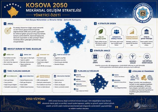
Together with the Urban Planning Commission of the Union of Turkic World Engineers and Architects (TDMMB), we prepared national spatial strategy reports for Kosovo and the Turkish Republic of Northern Cyprus on a pro bono basis.

International

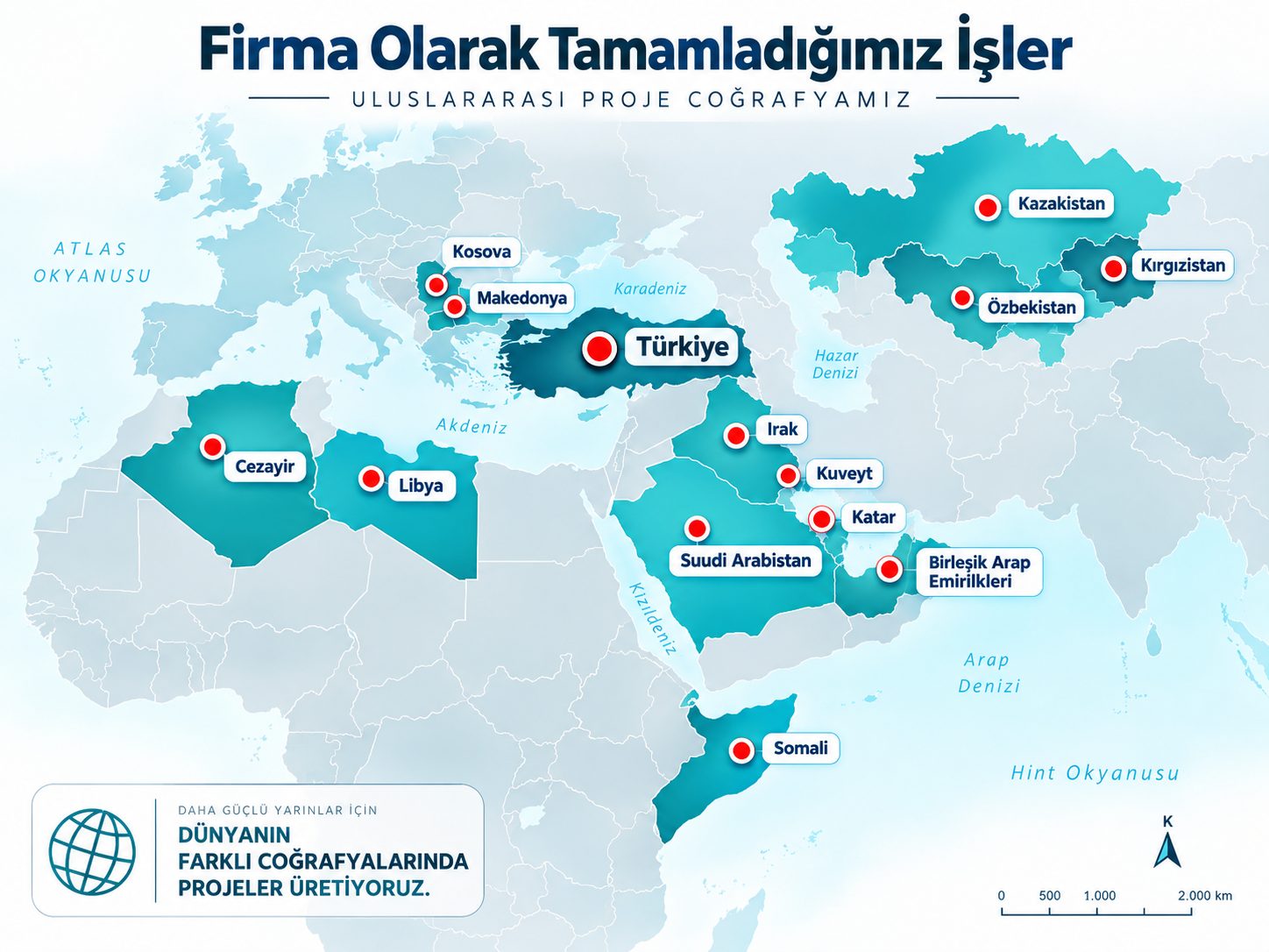
From Central Asia to the Gulf

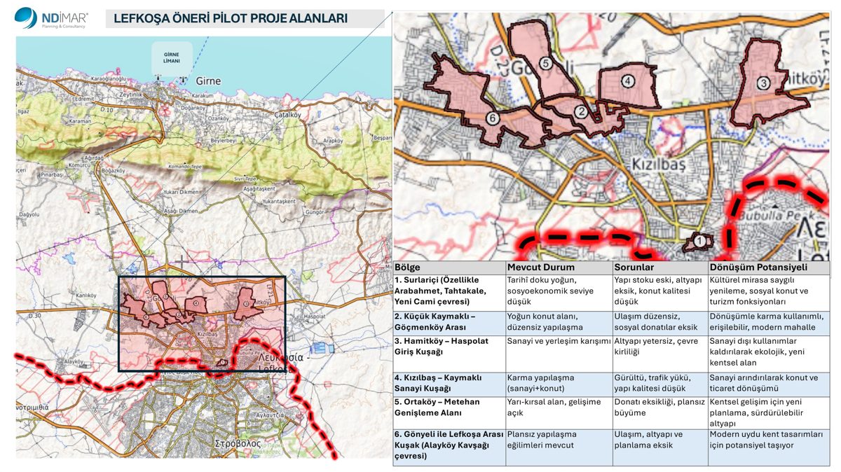
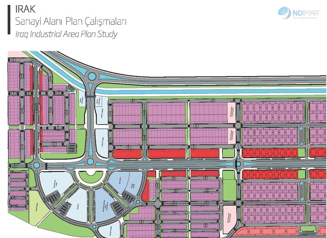
With our partners we deliver master plans, urban design, industrial and logistics areas.
  • Türkiye
  • Uzbekistan
  • Kazakhstan
  • Kyrgyzstan
  • Kosovo
  • Algeria
  • Libya
  • Tunisia
  • Iraq
  • Kuwait
  • Saudi Arabia
  • Qatar
  • UAE
  • Somalia
  • Northern Cyprus
  • North Macedonia
ND İmar uluslararası proje coğrafyası haritası: firma olarak tamamladığımız işler
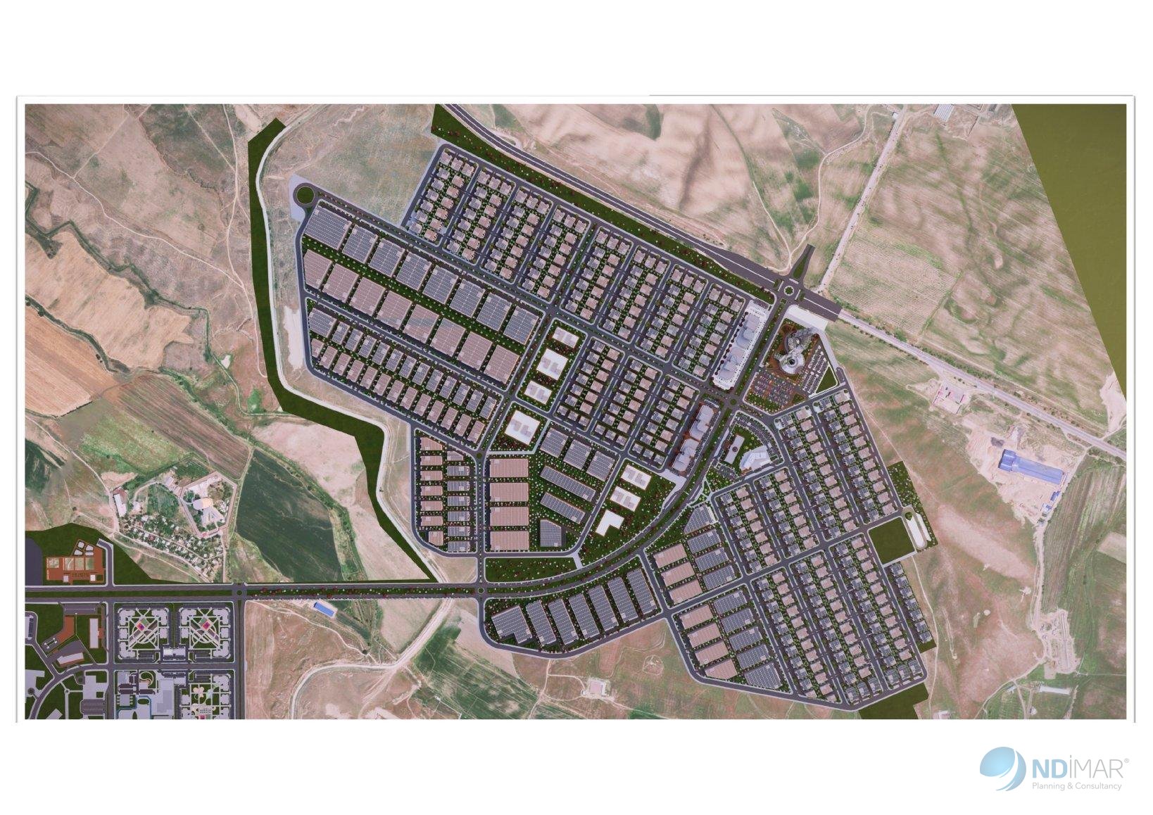
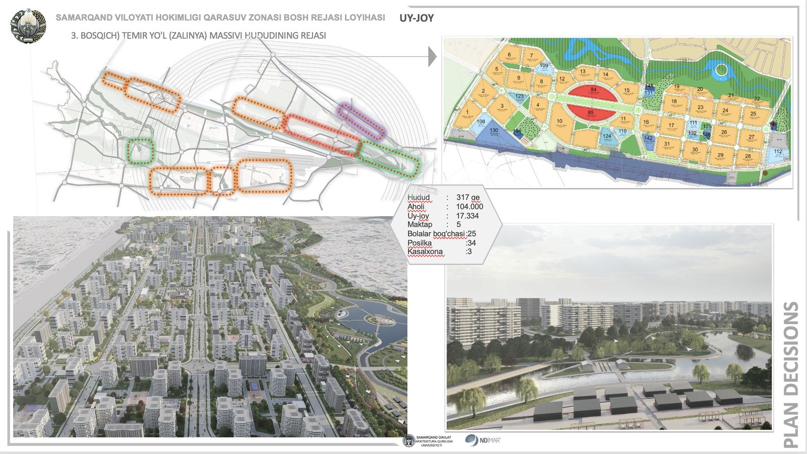
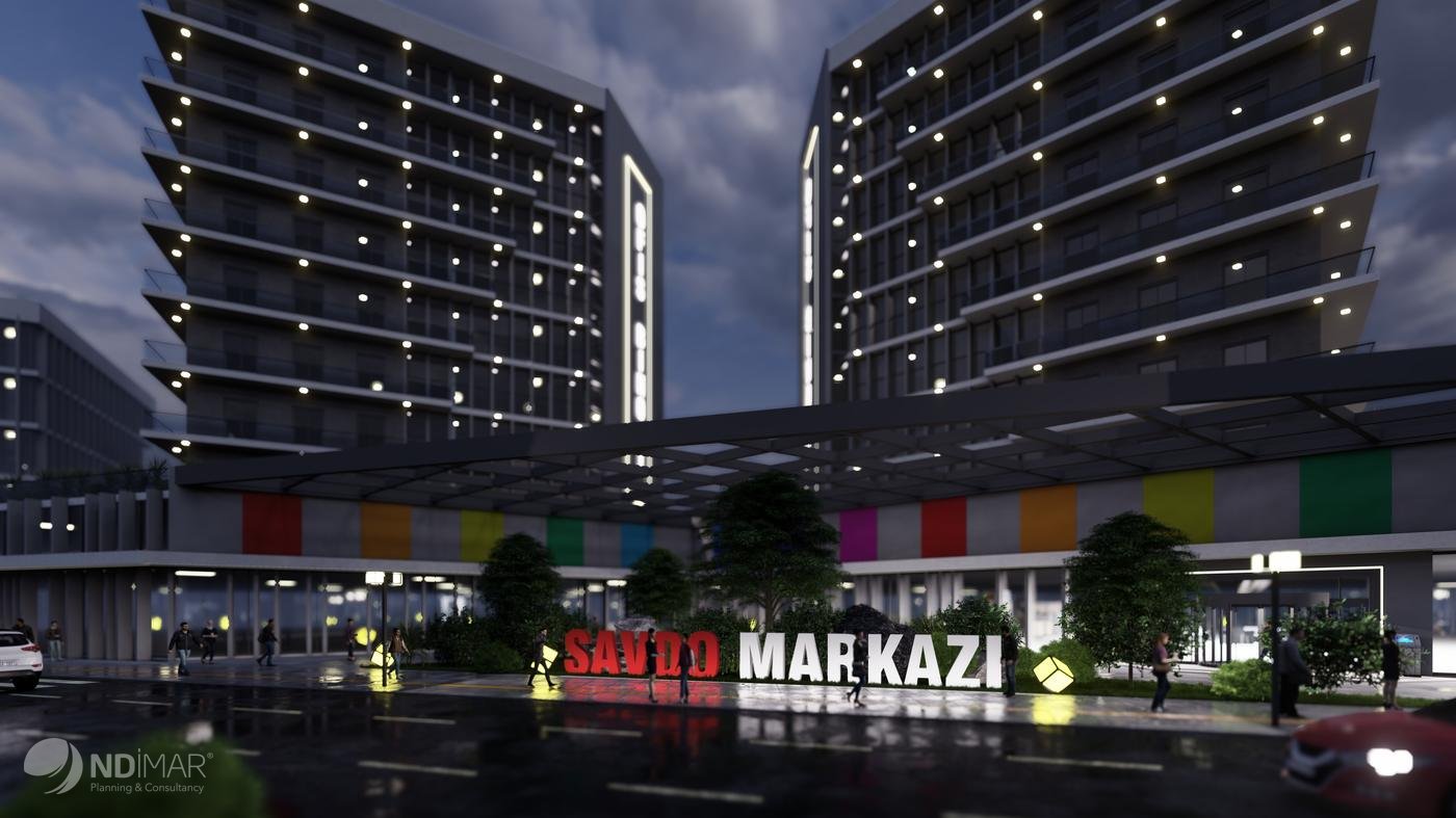
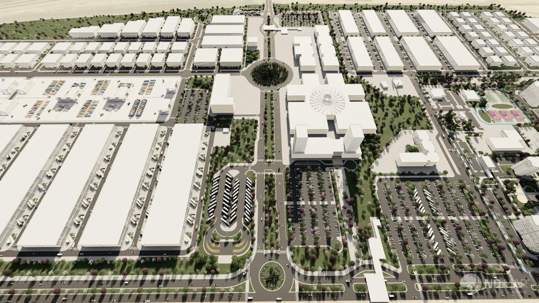
Özbekistan kentsel tasarım görselleştirmesi Özbekistan kentsel tasarım görselleştirmesi

Team

Planners, architects and surveyors

We work as a multidisciplinary team of city planners, architects, landscape architects, sociologists, a geologist and survey engineers, with academic advisors from universities.

Nadir DoğanChairman
Hasan DoğanGeneral Manager, Projects – Consultancy
Fatih Burak DoğanConstruction
Mustafa Buğra DoğanForeign trade & law
Abdullah Bilge DoğanFinance

Planning

Ömer Faruk Uyan

  • City planner5
  • Academic advisor (city planner)3
  • Sociologist2
  • Architect1
  • Geologist1
  • Geodesy1

Projects

Aslıhan Köroğlu

  • Architect6
  • Landscape architect2
  • Civil engineer1

Mapping & photogrammetry

Hasan Doğan

  • Survey engineer3

ND Lab · Future Lab

Future trends, R&D notes and brainstorming

We share the methods we test, the trends we follow and our open questions. Join in with your view.

Go to ND Lab →

Clients

Institutions we have planned for

Ministries and central government11

  • Prime Ministry of Türkiye
  • Ministry of Environment, Urbanisation and Climate Change
  • Ministry of Forestry and Water Affairs
  • Directorate General of Nature Conservation and National Parks
  • Ministry of Culture and Tourism
  • Ministry of Health
  • Housing Development Administration (TOKİ)
  • Presidency of Religious Affairs
  • General Directorate of Land Registry and Cadastre

  • Ankara Development Agency
  • DOKAP Regional Development Administration

Governorates, metropolitan municipalities and provincial administrations10

  • Istanbul Metropolitan Municipality (BİMTAŞ)
  • Ankara Metropolitan Municipality
  • Bursa Metropolitan Municipality
  • Kocaeli Metropolitan Municipality
  • Sakarya Metropolitan Municipality
  • Kayseri Metropolitan Municipality
  • Konya Metropolitan Municipality
  • Governorship of Bursa
  • Sakarya Special Provincial Administration
  • Batman Special Provincial Administration

Provincial and district municipalities53

  • Adapazarı Municipality
  • Aksaray Municipality
  • Akyazı Municipality
  • Arifiye Municipality
  • Çayırova Municipality
  • Çubuk Municipality
  • Darıca Municipality
  • Dilovası Municipality
  • Erciş Municipality
  • Erenler Municipality
  • Etimesgut Municipality
  • Ferizli Municipality
  • Gebze Municipality
  • Gemlik Municipality
  • Geyve Municipality
  • Hacılar Municipality
  • Hendek Municipality
  • İncesu Municipality
  • İnegöl Municipality
  • Kandıra Municipality
  • Karapürçek Municipality
  • Kartepe Municipality
  • Kastamonu Municipality
  • Kazan Municipality
  • Keçiören Municipality
  • Keleş Municipality
  • Kestel Municipality
  • Kırşehir Municipality
  • Kocasinan Municipality
  • Melikgazi Municipality
  • Meram Municipality
  • Mudanya Municipality
  • Niğde Municipality
  • Nilüfer Municipality
  • Osmangazi Municipality
  • Pamukova Municipality
  • Pursaklar Municipality
  • Sapanca Municipality
  • Sarıkaya Municipality
  • Selçuklu Municipality
  • Serdivan Municipality
  • Sincan Municipality
  • Sinop Municipality
  • Söğüt Municipality
  • Talas Municipality
  • Taraklı Municipality
  • Temelli Municipality
  • Tokat Municipality
  • Tosya Municipality
  • Trabzon Municipality
  • Van Municipality
  • Yıldırım Municipality
  • Yozgat Municipality

Industry, chambers, universities and cooperatives9

  • Başkent Organised Industrial Zone
  • Ankara Chamber of Commerce
  • OSTİM OIZ
  • İMES OIZ
  • Gebze Machinery OIZ
  • Gebze Chemicals OIZ
  • Ankara Chamber of Industry (ASO)
  • Hacettepe University
  • Türk Konut Housing Cooperative

International7

  • Samarkand Regional Hokimiyat · Uzbekistan
  • Jizzakh Regional Hokimiyat · Uzbekistan
  • Oʻzbekiston Iqtisodiyot Assambleyasi (Economic Assembly of Uzbekistan)
  • Surkhandarya Regional Administration · Uzbekistan
  • Municipality of Čair · North Macedonia
  • Kuwait Ports Authority
  • Union of Turkic World Engineers and Architects (TDMMB)

Registration

Credentials

Planning licence (founder)A (sınırsız)
Chamber of City Planners office registrationNo 706 · 1996
Ankara Chamber of CommerceNo 12884 · 1994
Trade registry number95875
Activity code (NACE)71.11.02

Contact

Talk to us about your project

Head office · Ankara

Yukarı Öveçler Mah. 1238. Cad. No: 9/A
06460 Çankaya / Ankara

Phone & email

+90 312 480 03 00

info@ndimar.com.tr